Ireland was placed under a series of weather warnings as Storm Austen, the first named storm of the 2026/27 season, approached the country with heavy rain, strong winds and a heightened risk of flooding.
Met Éireann, Ireland’s national meteorological service, issued Status Orange and Status Yellow warnings covering several parts of the country, warning of difficult travel conditions, flooding and disruption to public transport.
Storm Austen was expected to reach Ireland from Thursday evening, with the most significant impacts occurring overnight into Friday.
Orange rain warnings issued
The highest-level warnings were issued for Cork, Kerry and Waterford, where intense rainfall was expected from 10pm Thursday until 5am Friday.
The orange warning was subsequently extended to Dublin, Wexford and Wicklow, where it was in force from 2am until 8am Friday.
Met Éireann warned that the intense rainfall could lead to significant flooding, while travel conditions were expected to become very difficult. Disruption to rail and bus services was also possible.
A broader Status Yellow rain and wind warning covered Leinster and Munster from 7pm Thursday until 10am Friday.
The warning highlighted the possibility of localised flooding, difficult driving conditions, fallen trees and branches, displaced loose objects and disruption to outdoor events.
Storm Austen brings strong winds
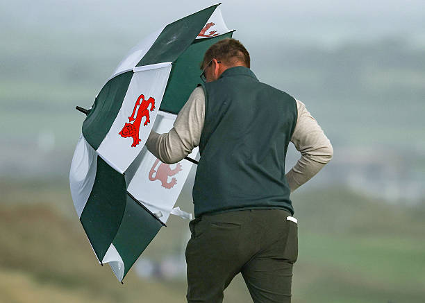
The storm was also expected to bring strong winds across Ireland.
Met Éireann said easterly winds would turn northwesterly and strengthen, particularly across southern and southeastern areas.
Separate marine warnings were issued for Irish waters, with winds expected to reach gale-force conditions in places. A small-craft warning covered all Irish coasts, while a marine gale warning was issued for waters between Fair Head, Carnsore Point and Slyne Head.
Authorities warned people near the coast and waterways to take additional care because of the combination of heavy rain, strong winds and potentially dangerous conditions.
Flooding concerns across Ireland
The rainfall associated with Austen raised concerns about river levels and surface-water flooding, particularly in areas that received prolonged or intense rainfall.
Several rivers and catchments were identified as vulnerable to rising water levels, including parts of the Suir, Nore, Barrow, Liffey and Dublin Bay areas.
Flooding concerns also extended to parts of Cork, Wexford, Wicklow and Waterford, with emergency authorities monitoring river levels and coastal areas.
Local authorities activated severe-weather response measures ahead of the storm.
Waterford City and County Council said crews would remain on call, while fire and swift-water response teams were prepared to respond if required. Sandbags were also made available at several council depots.
In Dublin, the city council's flood-response teams prepared for the possibility of localised flooding.
Public warned to prepare for disruption
Authorities urged residents to avoid unnecessary journeys during the worst of the weather and to remain alert for fallen trees, debris and flooded roads.
ESB Networks warned of possible electricity outages and advised households to prepare by keeping essential supplies available, including torches, batteries, a battery-powered radio and fully charged mobile phones. People were also warned never to approach fallen electricity lines.
Bus Éireann warned passengers that heavy rain and strong winds could cause disruption, although services were initially scheduled to operate normally.
Transport authorities cautioned that even after weather warnings expired, flooding could continue for several hours in some locations.
Dublin Marathon conditions could be affected
The storm also raised concerns about conditions for the Dublin Marathon, scheduled for Sunday.
Met Éireann meteorologist Gerry Murphy said the country would remain wet and conditions could be blustery, although the worst of Storm Austen was expected to have passed by then.
Organisers and participants were therefore advised to monitor the latest forecasts as conditions developed.
Austen is first named storm of the season
Storm Austen is the first named storm of the 2026/27 storm season.
The name was selected by Met Éireann in honour of Austen H. Nagle, who became the first director of the Irish Meteorological Service after his appointment in 1936.
The storm naming system is used to help authorities and the public communicate clearly about potentially impactful weather events.
However, Austen was not expected to be the last major weather system affecting Ireland during the weekend.
Another storm follows Austen
As Storm Austen moved away, meteorological authorities were already monitoring a second system, Storm Boelo, which was expected to affect Ireland during the Bank Holiday weekend.
Met Éireann subsequently issued further warnings as Boelo approached, meaning Ireland faced successive periods of heavy rain and strong winds rather than a single isolated weather event.
The arrival of Boelo increased concerns about saturated ground and the potential for additional flooding following the rainfall brought by Austen.
The National Severe Weather and Flood Coordination Group was scheduled to continue meeting to assess developments and coordinate the response.
The Irish Coast Guard, Water Safety Ireland and the RNLI also appealed to the public to take extra care around coastlines and inland waterways during the unsettled weather.
Residents urged to remain alert
Authorities stressed that weather warnings can change as a storm's track and intensity become clearer.
Residents were encouraged to monitor updates from Met Éireann and follow advice from local authorities, particularly in areas vulnerable to flooding or coastal impacts.
Drivers were advised to expect standing water, reduced visibility, debris and difficult road conditions, while residents in flood-prone areas were urged to take precautions before rainfall intensified.
The combination of heavy rain, strong winds and saturated ground can also increase the risk of fallen trees and branches, while flooding can remain dangerous even after rainfall begins to ease.
Storm Austen therefore presented Ireland with a significant early-season weather event, while the arrival of Storm Boelo shortly afterwards underscored the continuing unsettled conditions expected across the country.